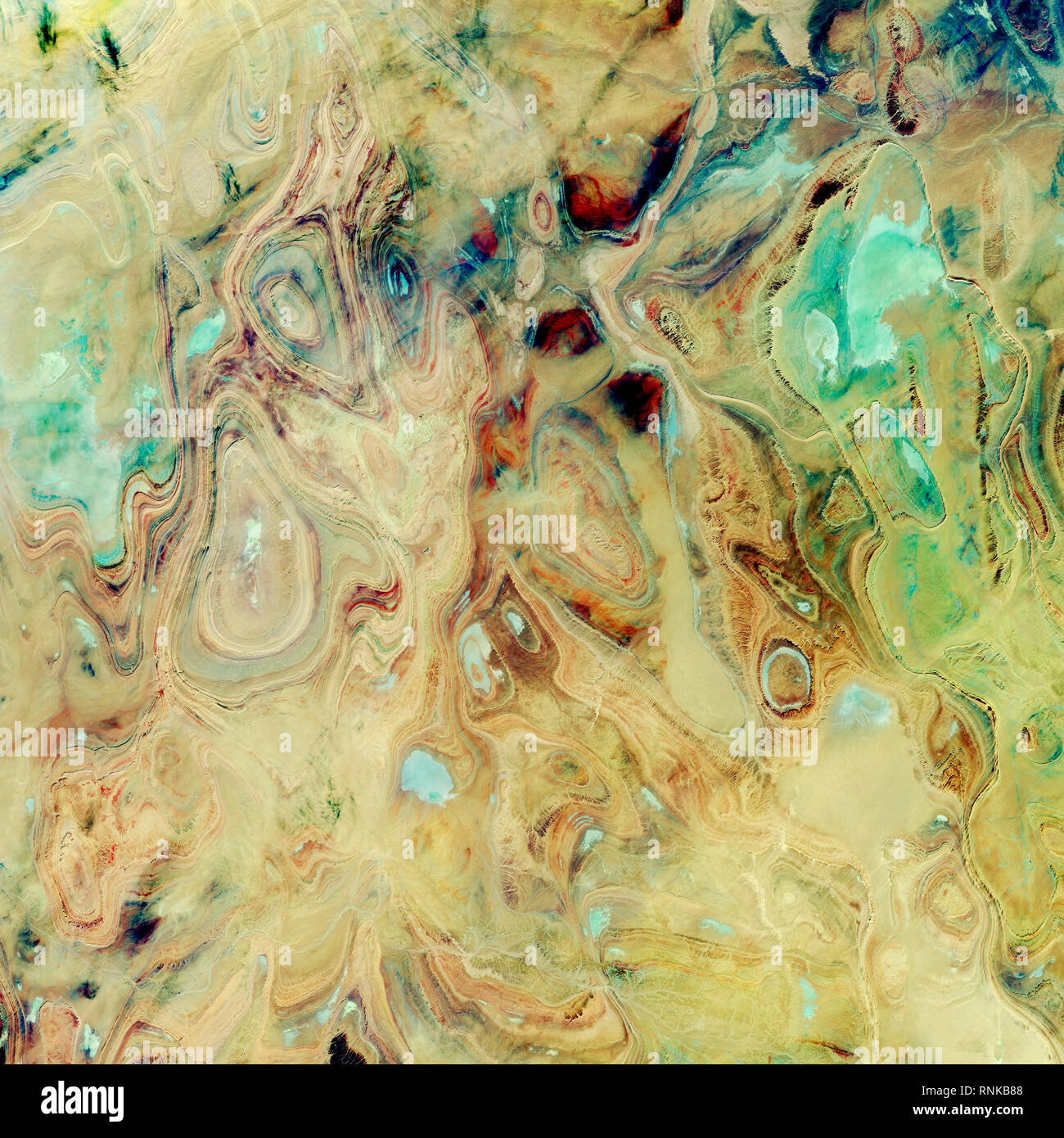
Bassin de Tanezrouft, l'Algérie dans cette partie du Sahara, connu sous le nom de bassin de Tanezrouft, le terrain est particulièrement aride, avec des précipitations annuelles mesurées en
4000 x 4000 px | 33,9 x 33,9 cm | 13,3 x 13,3 inches | 300dpi
Date de la prise de vue:
9 novembre 2017
Informations supplémentaires:
Tanezrouft Basin, Algeria In this part of the Sahara, known as the Tanezrouft Basin, the land is especially parched, with annual rainfall measured in millimeters (less than 5 millimeters or 0.2 inches). This is a hyperarid place of soaring temperatures and scarce access to water or vegetation. There are no permanent residents here, only occasional Tuareg nomads. The basin’s colloquial name is the “Land of Terror” because, for many, to traverse this land is to stare death in the face. The severe conditions that make this basin a barren expanse for life also lay bare its exquisite geology. Wind erosion—caused by constant sandblasting through millennia of frequent sandstorms—has exposed ancient folds in the Paleozoic rocks. This natural-color image, acquired on October 22, 2017, by the Operational Land Imager (OLI) on Landsat 8, shows concentric rings of exposed sandstone strata that create stunning patterns across the Tanezrouft Basin. When viewed from 705 kilometers (438 miles) above Earth, the exposed geologic features create an arresting work of abstract art.