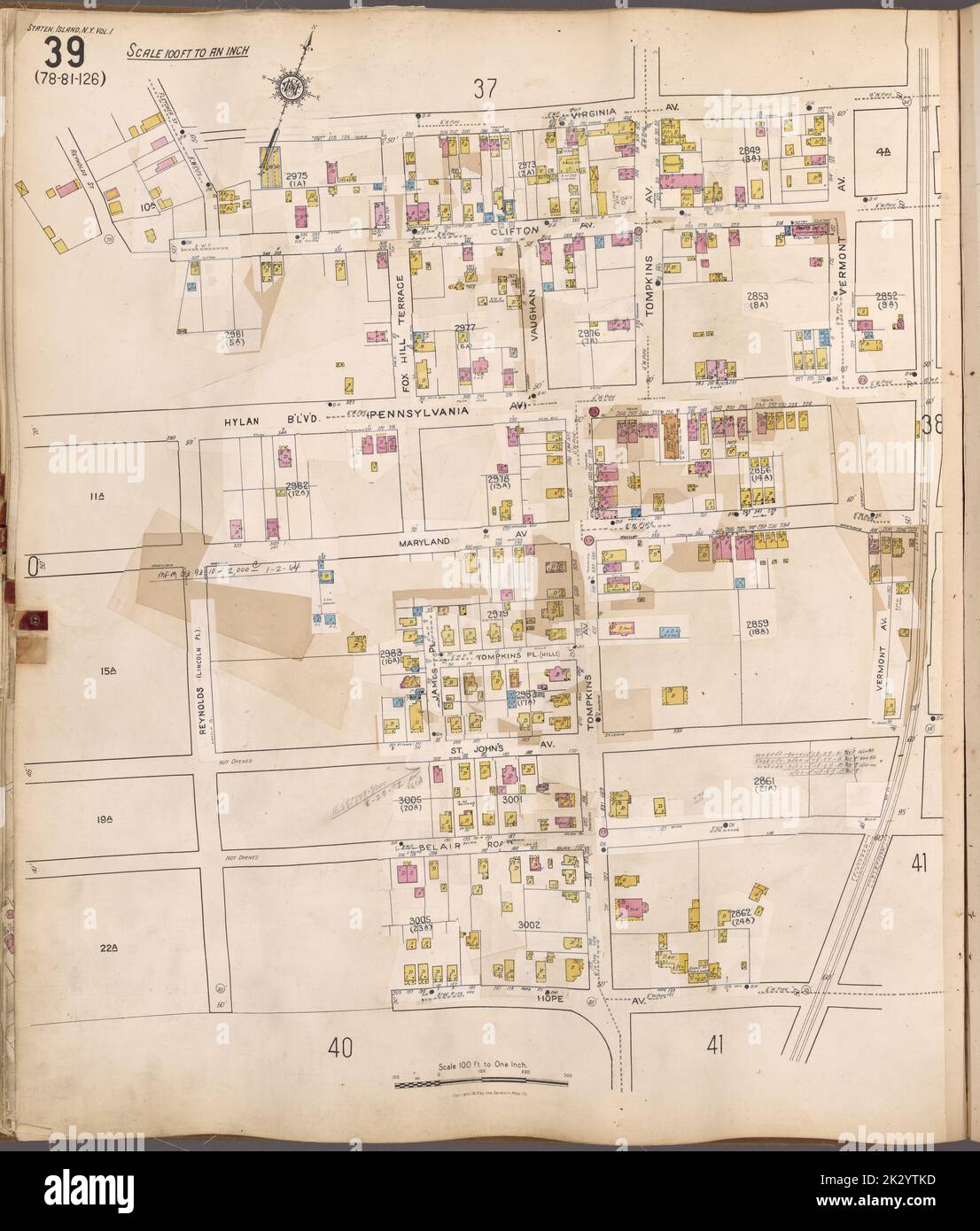
Cartographic, Maps. 1917. Lionel Pincus and Princess Firyal Map Division. Real property , New York (State) , New York, Fire insurance , New York (State) , New York, Staten Island (New York, N.Y.) Staten Island, V. 1, Plate No. 39 Map bounded by Virginia Ave., Hope Ave., Reynolds
RMID:ID de l’image:2K2YTKD
Détails de l'image
Contributeur:
Ny/piemagsID de l’image:
2K2YTKDTaille du fichier:
74,1 MB (2,7 MB Téléchargement compressé)Autorisations:
Modèle - non | Propriété - nonUne autorisation est-elle nécessaire?Dimensions:
4697 x 5517 px | 39,8 x 46,7 cm | 15,7 x 18,4 inches | 300dpiInformations supplémentaires:
Cette image appartient au domaine public, ce qui signifie que le droit d’auteur a expiré ou que le titulaire du droit d’auteur a renoncé à ses droits. Les frais facturés par Alamy couvrent l’accès à la copie haute résolution de l’image.
Cette image peut avoir des imperfections car il s’agit d’une image historique ou de reportage.