7429 x 6229 px | 62,9 x 52,7 cm | 24,8 x 20,8 inches | 300dpi
Date de la prise de vue:
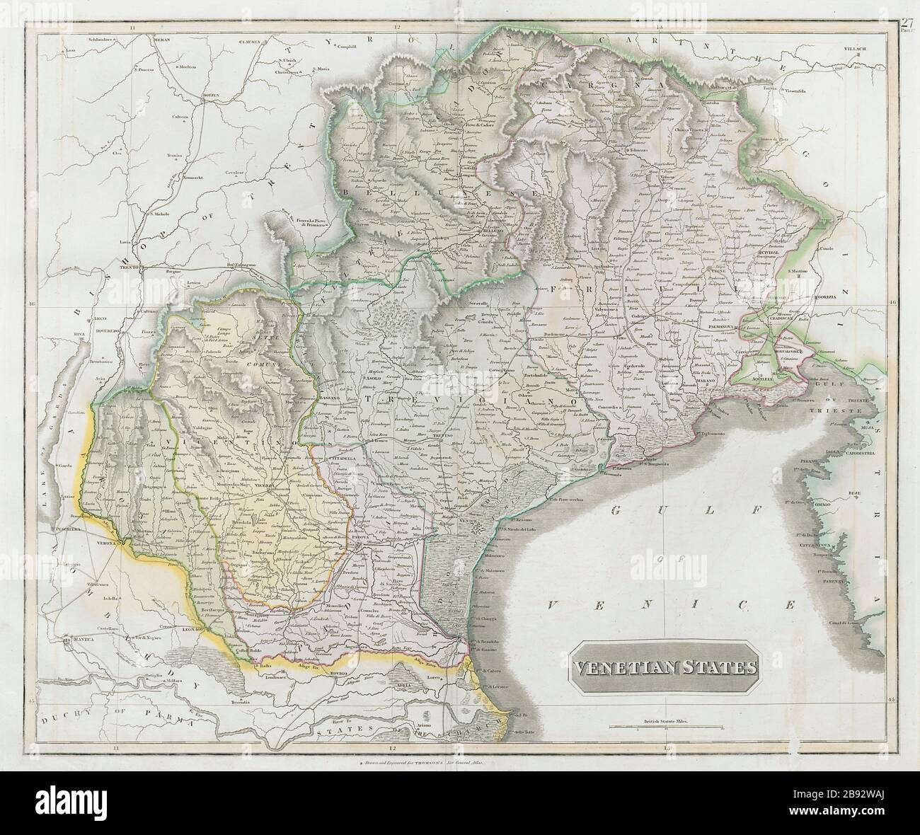
1830
Lieu:
Italy
Informations supplémentaires:
Cette image peut avoir des imperfections car il s’agit d’une image historique ou de reportage.
Venetian States. Artist/engraver/cartographer: Drawn & engraved by Nathaniel Robert Hewitt for John Thomson's "New General Atlas". Provenance: "A new general atlas", consisting of a series of geographical designs, on various projections, exhibiting the form and component parts of the globe; and a collection of maps and charts, delineating the natural and political divisions of the Empires, Kingdoms, and States in the World", Edinburgh: Printed by George Ramsay and Company, for John Thomson and Company, Edinburgh; Baldwin, Cradock, and Joy, London; and John Cumming, Dublin [Thomson's New General Atlas]. Type: Antique early 19th century atlas map with original hand colouring. This large map shows the main contiguous part of the Republic of Venice, although as an entity it had ceased to exist in 1797