···
Grèce carte politique des divisions administratives RF ID: ID de l’image: 2MX82BX Détails de l'image Informations supplémentaires:
Greece political map of administrative divisions - decentralized administrations and autonomous monastic state of Mount Athos. Thin black outline map with division name labels.
Description en anglais
Recherche dans la banque de photos par tags
Vecteurs similaires RF 2MR414D – Greece political map of administrative divisions RF 2F94JC3 – Albania map. Stylized vector map illustration with cities, administrative divisions RF 2YACRF7 – Europe map with administrative divisions borders. Soft beige color palette. Vector illustration RF PJ2063 – Greece map with borders, cities, capital and administrative divisions. Infographic vector map. Editable layers clearly labeled. RF 3B1Y2F1 – Map of Eastern Europe. Includes Ukraine, Belarus, Romania, Bulgaria, Hungary Slovakia Czechia and Poland with regional divisions. Isolated on a white RF 2SBRF56 – Vector map of Greece with regions or territories and administrative divisions. Editable and clearly labeled layers. RF 2H69EXB – Greece map, individual regions with names, Infographics and icons vector RF 2MPRRND – Greece political map of administrative divisions RF 2YACRFE – Europe detailed colored map with administrative divisions borders. Vector illustration RF PH5Y5A – Stylized vector Greece map showing big cities, capital Athens, administrative divisions and country borders RF 3B1Y2F6 – Map of Central Europe Includes Switzerland Germany Poland Hungary and Austria with regional divisions. Isolated on a white background Highly detailed RF 2SBRJ89 – Vector map of Greece with regions or territories and administrative divisions. Editable and clearly labeled layers. RF 2MX5R49 – Greece political map of administrative divisions 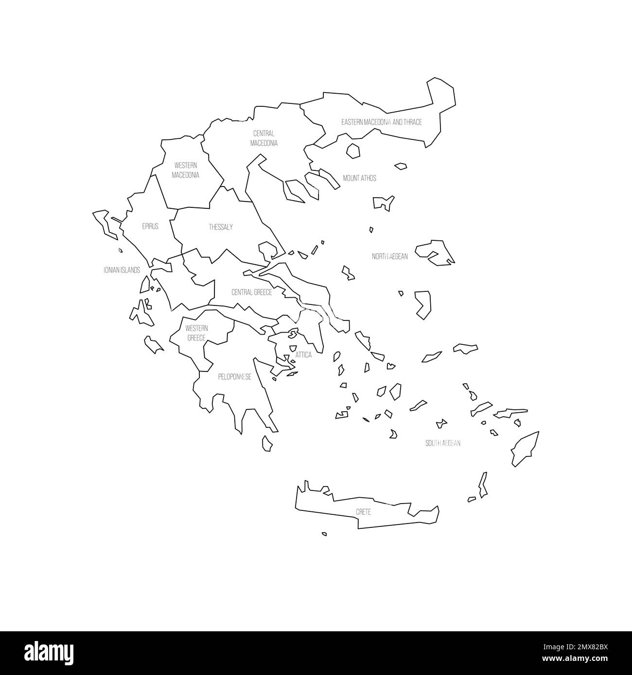