Taille du fichier:
40,3 MB (3,8 MB Téléchargement compressé)
Ouvrez votre fichier d’image à la taille réelle à l’aide du logiciel de traitement d’images.
Dimensions:
4425 x 3181 px | 37,5 x 26,9 cm | 14,8 x 10,6 inches | 300dpi
Date de la prise de vue:
21 mai 2018
Informations supplémentaires:
Cette image peut avoir des imperfections car il s’agit d’une image historique ou de reportage.
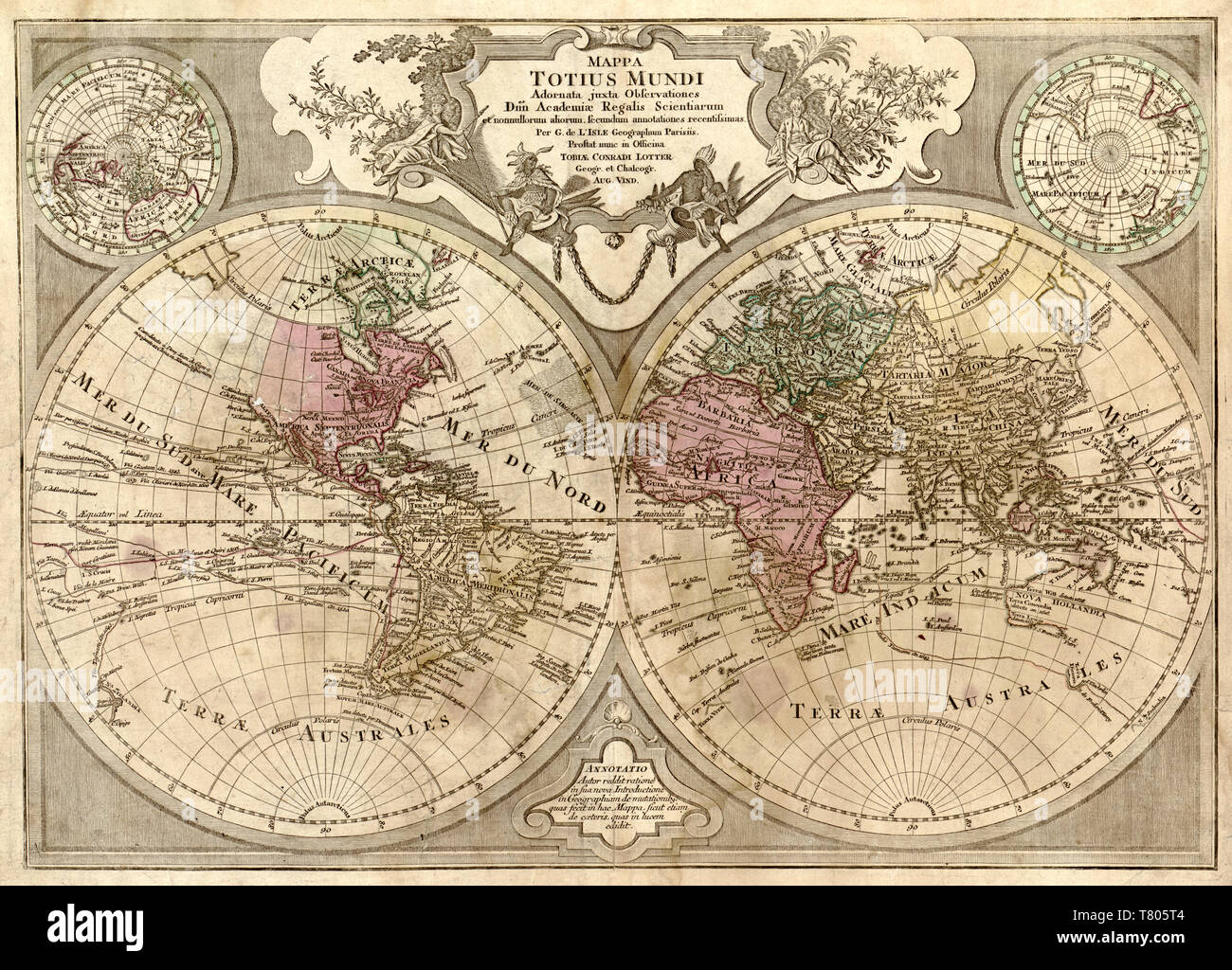
Mappa totius mundi: adornata juxta observationes dnn. academiae regalis scientiarum et nonnullorum aliorum secundum annotationes recentissimas. Includes note, illustrations, and ancillary maps of the northern hemisphere and southern hemisphere. Guillaume Delisle (February 28, 1675 - January 25, 1726) was a French cartographer known for his popular and accurate maps of Europe and the newly explored Americas. Like many cartographers of his day, Delisle did not travel with the explorers. He drew maps mostly in his office, relying on a variety of data. The quality of his maps depended on a solid network to provide him first-hand information. Delisle had access to recent accounts of travelers who were returning from the New World, which gave him an advantage over his competitors. He also kept current with recent discoveries, especially in astronomy and measurement. When he could not confirm the accuracy of a source, he would indicate it clearly on his maps. Appears in Tobias Conrad Lotter's Atlas géographique de cent et huit cartes générales et spéciales. Augsburg, 1778.