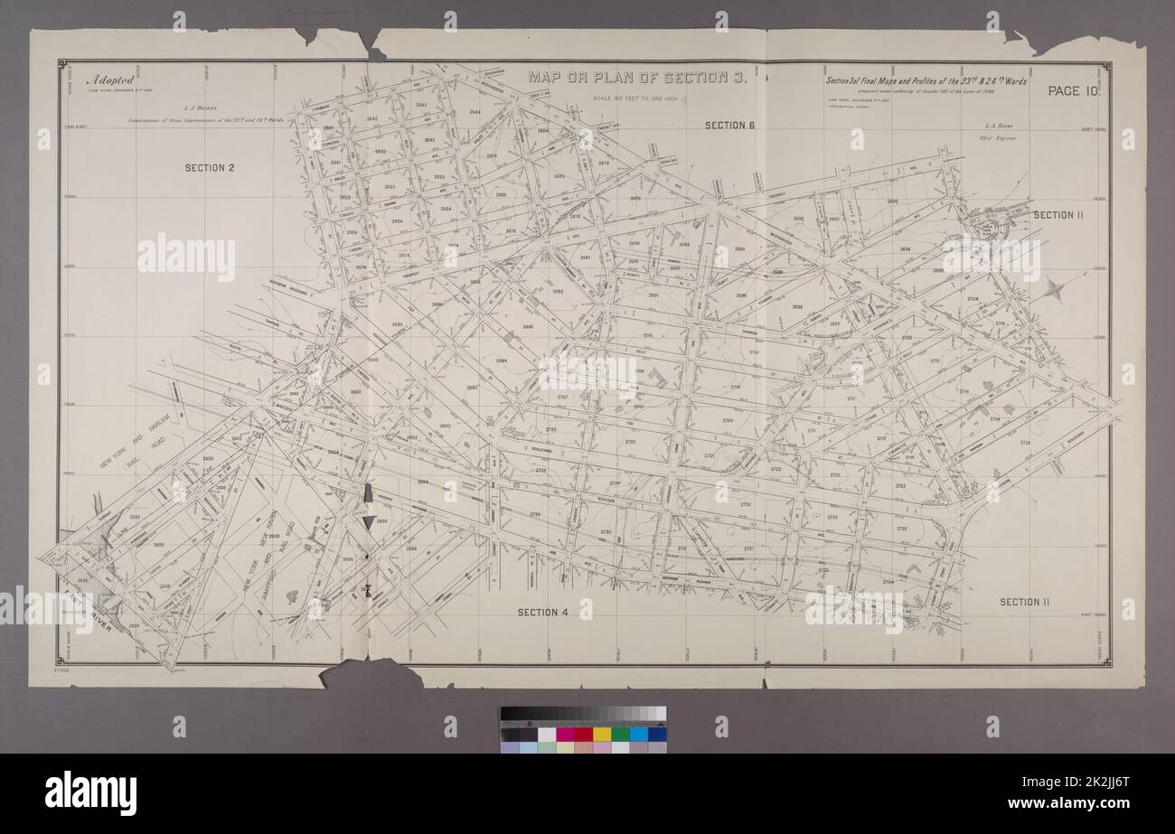
New York (N.Y.). Topographical Bureau. Cartographic, Maps. 1892 - 1895. Lionel Pincus and Princess Firyal Map Division. Bronx (New York, N.Y.) Map or Plan of Section 3. Bounded by Robbins Avenue, Westchester Avenue, Prospect Avenue, E. 165th Street, Westchester Avenue, Southern Boulevard, Hunts Point Road, Mohawk Avenue, Randall Avenue, Bungay Street and E. 149th Street. Section 3 of Final Maps and Profiles, of the 23rd & 24th Wards.
RMID:ID de l’image:2K2JJ6T
Détails de l'image
Contributeur:
Ny/piemagsID de l’image:
2K2JJ6TTaille du fichier:
95,9 MB (2,8 MB Téléchargement compressé)Autorisations:
Modèle - non | Propriété - nonUne autorisation est-elle nécessaire?Dimensions:
7230 x 4638 px | 61,2 x 39,3 cm | 24,1 x 15,5 inches | 300dpiDate de la prise de vue:
7 juillet 2006Informations supplémentaires:
Cette image appartient au domaine public, ce qui signifie que le droit d’auteur a expiré ou que le titulaire du droit d’auteur a renoncé à ses droits. Les frais facturés par Alamy couvrent l’accès à la copie haute résolution de l’image.
Cette image peut avoir des imperfections car il s’agit d’une image historique ou de reportage.