13043 x 10160 px | 110,4 x 86 cm | 43,5 x 33,9 inches | 300dpi
Date de la prise de vue:
1832
Lieu:
Scotland
Informations supplémentaires:
Cette image peut avoir des imperfections car il s’agit d’une image historique ou de reportage.
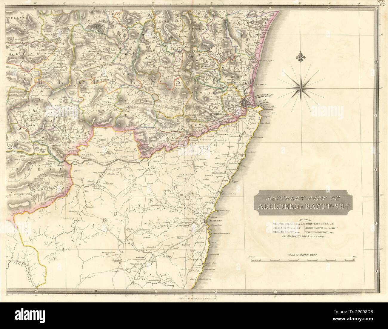
[Southern part of Aberdeen & Banff-shrs. - east sheet] [Aberdeenshire]. Artist/engraver/cartographer: Published by John Thomson. Engraved by E Butterworth. Attested by George Imlach Esqr. J.P.; J.D. Mackay Esqr. J.P.; George Grant Esqr.; John Smith Esqr., Banff; John Taylor Esqr. J.P.; William Robinston Esqr.; Alastair Irvine Ross, Land Surveyor; . Provenance: "The Atlas of Scotland containing maps of each county on a scale so large as to exhibit the features of the country and places of importance; the boundaries of the shires, attested with respectable names to verify their accuracy laid down from actual survey or compiled from plans of recent date, so as to form a complete body of topographical information at the date of publication.", printed for John Thomson & Co. Edinburgh; Baldwin & Cradock, London; and John Cumming, Dublin. Type: Antique early 19th century atlas map with original hand colouring. Places named on the map include: Aberdeen, Inverurie, Dyce