3991 x 3192 px | 33,8 x 27 cm | 13,3 x 10,6 inches | 300dpi
Date de la prise de vue:
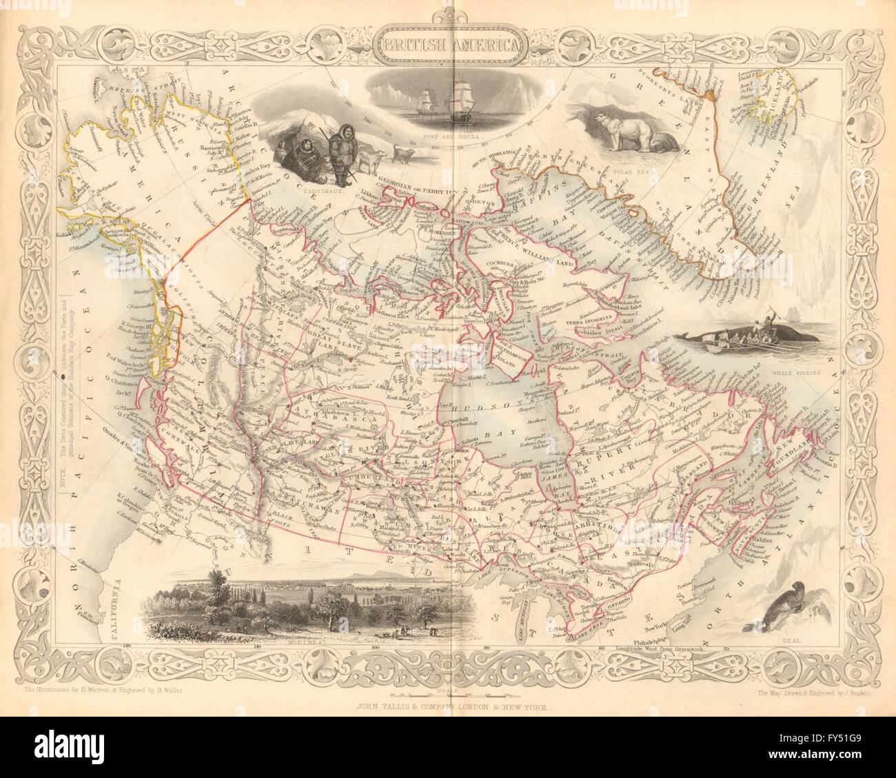
1849
Lieu:
Canada
Informations supplémentaires:
Cette image peut avoir des imperfections car il s’agit d’une image historique ou de reportage.
'British America'. Artist/engraver/cartographer: Map drawn and engraved by J. Rapkin; vignette illustrations drawn by H Warren & engraved by Robert Wallis. Published by John Tallis & Co. Provenance: "The British Colonies' their history, extent, condition and resources", by Montgomery Martin Esq. Published by John Tallis & Company, London & New York. Type: Antique engraved map by J Rapkin, published by John Tallis. Original outline hand colour, decorative border, and attractive inset vignette views. The key indicates that the brown dots are forts and principal stations of the Hudson's Bay Company. Vignettes: Whale fishing; Esquimaux; Polar bears; Seal; Montreal; Fury and Hecla. Canada. Alaska is indicated as "Russian America" as it was prior to its sale to the United States in 1867. Baffin Island marked "Terra Incognita".