4164 x 3217 px | 35,3 x 27,2 cm | 13,9 x 10,7 inches | 300dpi
Date de la prise de vue:
1849
Lieu:
World
Informations supplémentaires:
Cette image peut avoir des imperfections car il s’agit d’une image historique ou de reportage.
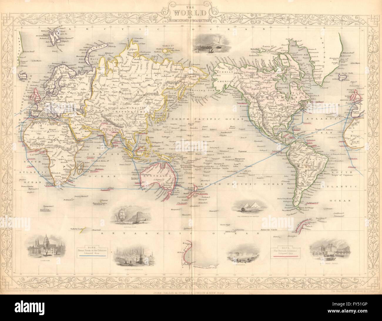
'The World on Mercator's Projection'. Artist/engraver/cartographer: Map drawn and engraved by J. Rapkin; vignette illustrations drawn by H Warren & engraved by JB Allen. Published by John Tallis & Co. Provenance: "The British Colonies' their history, extent, condition and resources", by Montgomery Martin Esq. Published by John Tallis & Company, London & New York. Type: Antique engraved map by J Rapkin, published by John Tallis. Original outline hand colour, decorative border, and attractive inset vignette views. Vignettes: Gibraltar; London; Constantinople; Niagara; The Pyramids of Ghizeh; Pont Neuf, Paris; Vesuvius. The steam ship routes to the colonies are marked in blue, and the British Empire with its colonies are marked in pink. Marked on the map are the Mountains of Kong and the Mountains of the Moon, non-existent mountain ranges charted on English maps of Africa from 1798 through the late 1880s. An early map resulting from exploration of the area and showing this west to east mountain range in 1798 was produced by English cartographer James Rennell. The Mountains of Kong were thought to begin in West Africa near the highland source of the Niger River near Tembakounda in Guinea, then continue east to the also fictitious central African Mountains of the Moon, thought to be where the White Nile rose. Cartographers stopped including the mountains on maps after French explorer Louis Gustave Binger established that the mountains were fictitious in his 1887-1889 expedition to chart the Niger River from its mouth in the Gulf of Guinea and through Côte d'Ivoire. Vignettes: Arab family of Algeria; Bosjesman Hottentotts (wild bushmen); St Helena; Korranna Hottentots; Bedouin Arabs encampment